My alarm jolted me awake early in the morning and I immediately noticed the sound of rain pounding the glass ceiling of the Tahuna Pod Hostel where I was staying. For the past week, I was hoping that the weather would clear up before I started the Routeburn Track – one of New Zealand’s 9 Great Walks. From what I’ve heard, the Routeburn Track is one of the best hikes in all of New Zealand, weather permitting. Unfortunately there was cyclone that was forecasted to touch down any day now on the South Island and it seemed like we were already starting to see the effects.
We made it to Queenstown the night before and unfortunately missed the closing time of the ranger station where I was to pick up the hiking permits. I trudged through the rain to the DOC office and patiently waited for it to open. After I had my hut tickets in hand, I hopped in my car and started driving to the Routeburn Shelter trailhead.
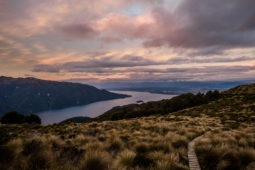
What followed was an hour of driving along Lake Wakatipu on windy roads, past the quaint town of Glenorchy. The weather was looking grim and the clouds looked gray and uninviting. After ditching the paved roads and up a dirt road past some very wet sheep, we finally arrived at the parking lot. Despite my best efforts, I still had quite a bit of packing to do at the trailhead. Fortunately, after we finished the last minute packing, it looked like luck was on our side and the rain had slowed to a drizzle and the clouds actually seemed to be dispersing.
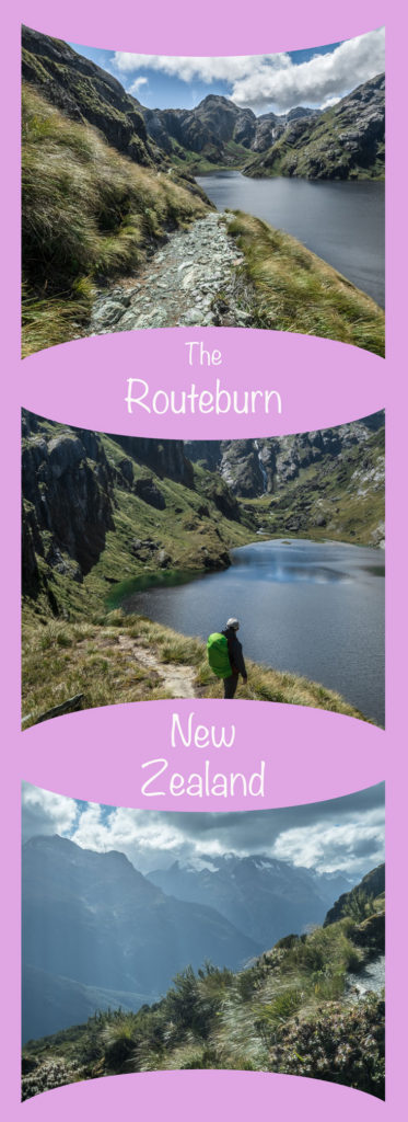
The Routeburn Track is not a particularly long walk – it is about 18 miles from start to finish on a well-maintained trail. Logistically, however, it poses something of a challenge since it is not a loop and the two trailheads, Routeburn Shelter and the Divide, are 324 kilometers apart by car. It would take a full day to car spot, so the only realistic options are to take a shuttle service, or to hire someone to pick up your car and drop it off on the other side. We chose the latter, so before setting off with my gear, I locked the car key into the lock box provided by Easyhike and fastened it onto the door handle. We set off hopeful that our car would be at the other side of the mountains when we were done hiking.
Day 1
Routeburn Kilometers 0.0 – 8.8
Almost immediately upon hitting the trail, the rain came to a complete stop. Several minutes later, the sky cleared and all of a sudden it was a beautiful day. At about kilometer two, I felt over dressed, so I stopped to shed a couple layers.
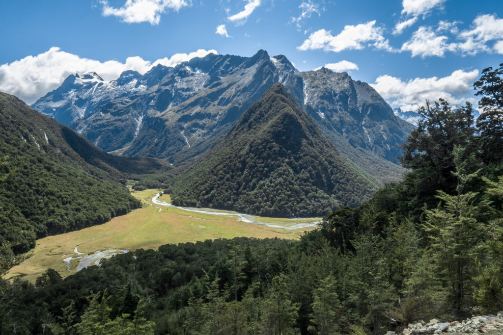
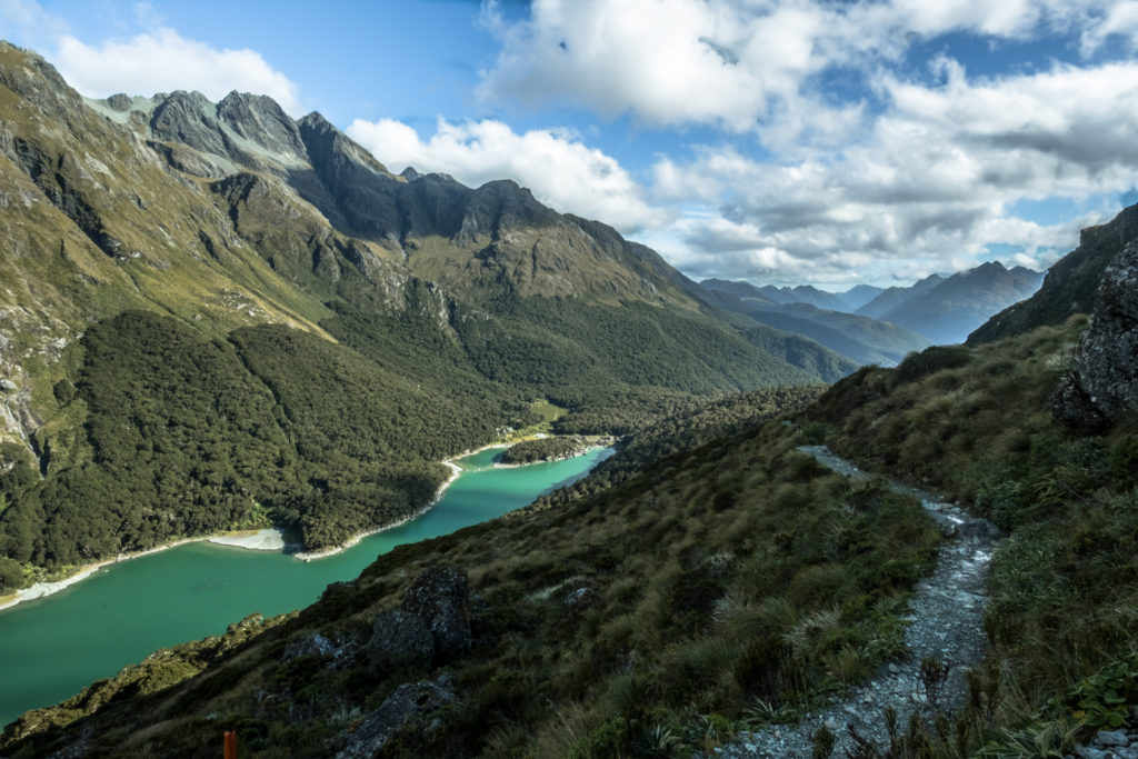
The first part of the Routeburn travels through temperate rainforest next to a canyon. The foliage in this section of the trail is exceptionally lush. The trail meanders next to a river, occasionally crossing over. If you love suspension bridges, there are plenty in this section of the trail to enjoy. Without much elevation gain, the mile markers to the Routeburn Flats hut went by quickly.
Once past Routeburn Flats, however, get ready to climb. The trail gains just shy of 1000 feet in about a mile. This part of the trail was still shrouded in trees, but every once in a while I came to a clearing with exceptional views of Mount Aspiring.
Finally, I arrived at the Routeburn Falls Hut and decided to stop for lunch. The Routeburn Falls hut is a destination in itself. It is perched on a cliff overlooking Mount Aspiring National Park while the Routeburn Falls roars next to it. I sat on the balcony of the hut eating a salami and cheese sandwich taking in the astounding views.
Routeburn Kilometers 8.9 – 12.6
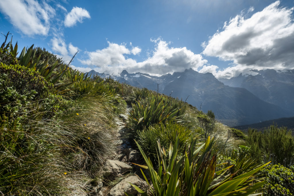
After I was finished eating lunch, it was time to get back to walking. The trail changes dramatically past the Routeburn Falls Hut. It leaves the rainforest and begins meandering through the alpine section of the trail. Immediately upon leaving the hut, I climbed a granite “staircase” next to the waterfall. When I reached the top, my jaw dropped.
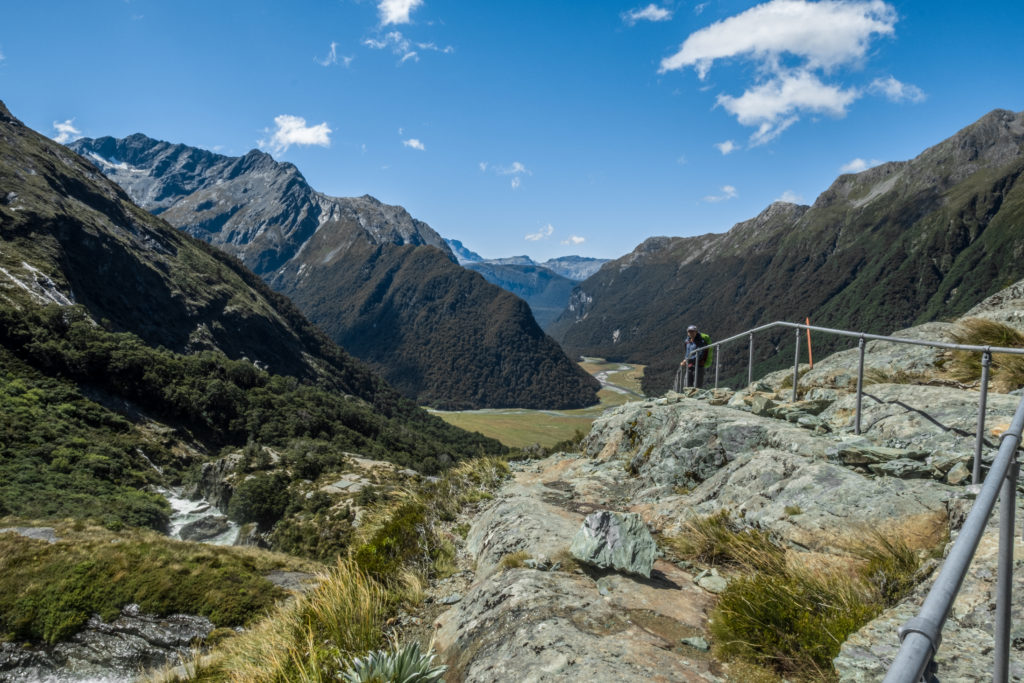
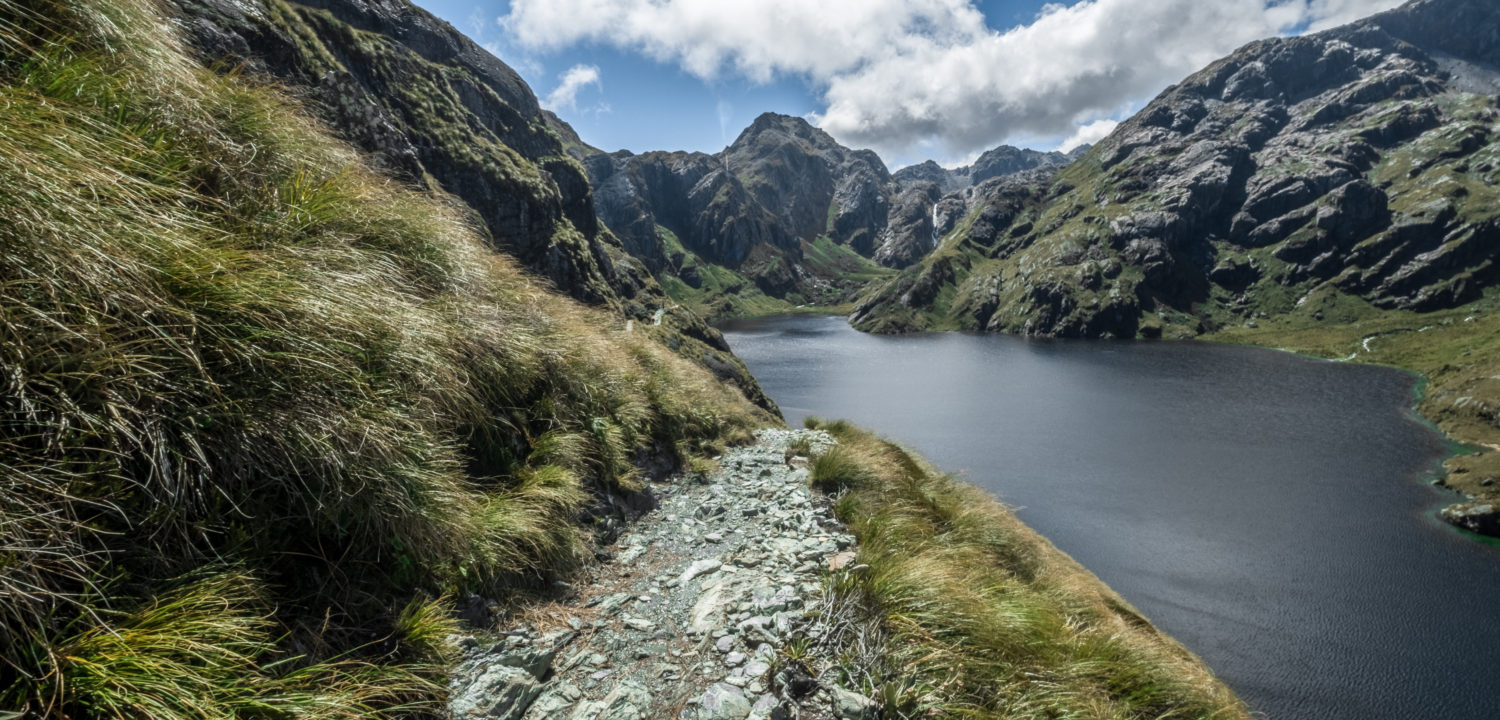
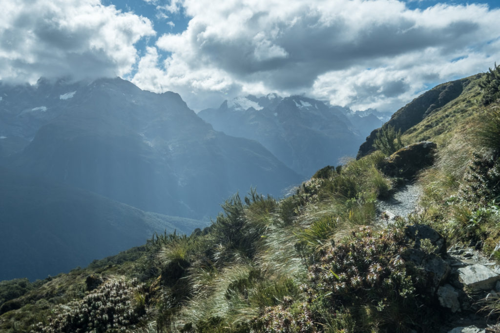
This section of the trail is spectacular. The trail is mostly flat through here, but it still took me quite a while to get through because I was stopping to take photos every few moments. The final march up to the Harris Saddle is some of the most spectacular backcountry I have ever experienced.
From the shelter on the top of the Harris Saddle, there is a side trip to the top of Conical Hill. I was feeling a bit short on time, though. I started making the trip up to the top, but turned around about ¾ of the way up due to time pressure. Apparently from the top, you can see all the way to the Tasman Sea.
Routeburn Kilometers 12.7 – 20.2
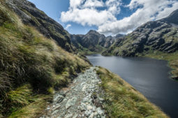
I got back down to the shelter and picked up my bag and began my gradual descent to Lake Mackenzie. The few miles immediately passed the Harris Saddle wind along the ridge just above the Hollyford River. Even though the trail was smooth and easy, walking alongside a steep slope still left me hugging the inside of the trail.
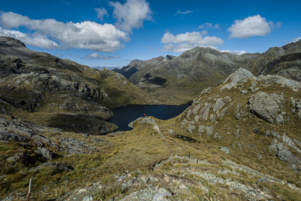
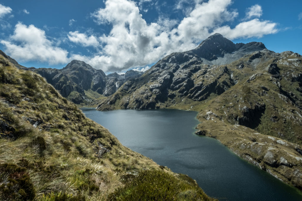
After about an hour of walking on the ridge, the trail turned away from the Hollyford, and I got my first view of Lake Mackenzie. From above, the lake looked absolutely stunning. I was relieved to see the lake, since the hut would be right next to it. It was also reassuring that the trail was pretty much all downhill to the hut. By my calculations, I would make it down to the hut well before the 7 PM check-in time.
At Lake MacKenzie Hut
Within half a mile of starting the descent, the foliage changed from alpine grasslands to mossy rainforest. I would learn later that night that this part of the trail is called the Fairy Glade. Despite the walk being all downhill, it still felt like a slog after the long day. When we finally arrived at the hut, we picked some bunks and immediately started preparing dinner. This was my first night in a DOC hut in New Zealand, and the facilities were surprisingly nice. I enjoyed my dehydrated meal and some Gomtang Ramen.
After dinner, the ranger gave a talk to us on the front porch of the hut. The talk was about the first ascent of Tutoko, the tallest mountain in Fiordland National Park. He was an interesting storyteller, and his tale kept everyone’s attention for a solid forty-five minutes. We learned that the Routeburn Track is the only Great Walk that goes through two national parks, and we spent most of this first day in Mount Aspiring National Park. By the time he was finished, the sun had set well below the mountains, and it was time to go to bed.
Day 2
After waking up, it was immediately apparent that our stroke of good weather had was all but fleeting. Fog enshrouded the whole valley. The stunning mountains that encircled our hut were no longer even visible. Packing up camp went quickly, we ate some oatmeal, and then hit the trail for the last 12 kilometers
Routeburn Kilometers 20.3 – 28.8
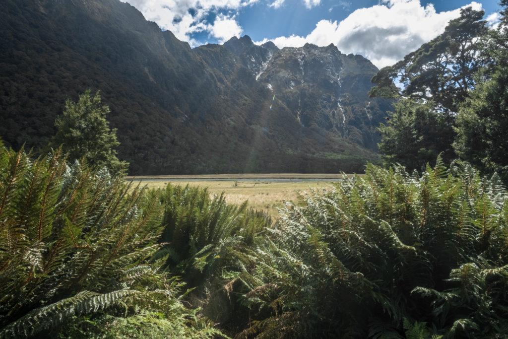
This section went by really quickly. The terrain was mostly flat and there was nothing to stop to gawk at on account of the dense fog. Immediately upon leaving Lake MacKenzie, we arrived in a beautiful meadow. It was idyllic, but I was a little too wet to stop and enjoy my surroundings.
After leaving the meadow, the trail began tracing the hillside. On my left I passed the occasional waterfall, one of which towered over the trail and covered it in mist. On my right, I could only see the abyss in the fog. After about an hour along the hillside, the trail entered the forest. It was lovely, but because the weather left a lot to be desired, it felt more like a slog.
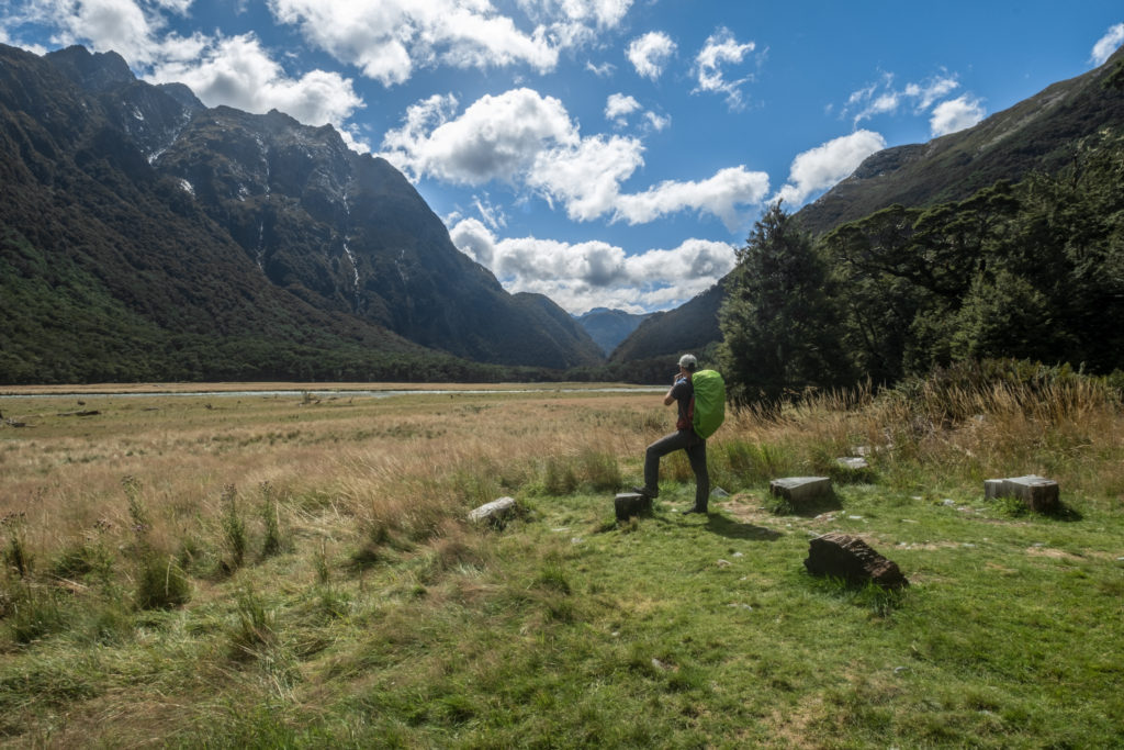
Two hours after leaving the hut, we arrived at the next hut along the trail. The walk up to the hut was on an elevated wooden path over some fragile meadows. Another gorgeous section of the trail that I didn’t get to fully enjoy on account of the wet and cold. We stopped for a quick bite of trail-mix and a trip to the loo, but we were so close to the trailhead and a bit anxious to finish up, so we quickly pushed on.
Routeburn Kilometers 28.9 – 32.3
Immediately upon leaving camp, we hit our last hill. It took about fifteen minutes to get to the top of the hill, at which point we started seeing day hikers who were hiking up to Key Summit. It was simultaneously a good thing to see day hikers: a sign that we had almost completed the trek, but it was also mildly infuriating since the previously empty trail became full of day hikers.
We decided against the side trip to Key Summit. There were quite a few people, and the fog almost guaranteed that there would not be any great view from the top. Instead, we pushed down the hill, through the rest of the forest towards the parking lot.
We spent the last half a kilometer discussing whether or not we thought the car would be in the parking lot at the end. Although the service had great reviews and seemed trustworthy, you could never be too sure of yourself. I put our odds at 75%, Dennis, the pessimist, put them at 40%.
At the Divide
Surely enough, we arrived at the trailhead and our car was not there. A stressful situation indeed, and we paced across the parking lot multiple times just to make sure. The trailhead, the Divide, was roughly one and a half hours from Milford Sound and two hours from Te Anau; effectively in the middle of nowhere. There also wasn’t any service so we wouldn’t have been able to contact the shuttle company.
We consulted the terms and conditions of the car shuttle service to see what our next steps would be. The terms stated that the car would arrive by Noon the day you finish the hike. Since it was only 11:30 so we decided we should wait at least twenty minutes before contemplating our next steps. We didn’t really think that they would make it at the last second but of course there was not much else we could do.
Thankfully, at 11:56, our car pulled up in the parking lot. We both breathed a sigh of relief. We packed our stuff into the car, and headed on our way to the see the famous Milford Sound.

Recent Comments